Maine Geospatial Institute Celebrates World GIS Day

Thanks to all who participated in MGI’s World GIS Day 2021! Please check back in Fall 2022 for MGI World GIS Day events.
Maps In Action!
From mapping novices to mapping pros, Mainers celebrated World GIS Day 2021 by collaborating on a map that shows everyone tapping into mapping in Maine – check out the Maps In Action! map now (External Site)!
Congrats to our five randomly selected World GIS Day 2021 Maps In Action! winners: Alyssa F., Andrew P., Anna O., Dianne F., and Richard D. These winners each receive Esri personal use ArcGIS software worth $100!
Be sure to check out last year’s Maps In Action! map (External Site), too.
Happy World GIS Day 2021!
“Using Technology to Make a Difference” – A Virtual Discussion with Maine Geospatial Students
Moderated by Andy Smith-Petersen, Geographic Information System Professional (GISP), who oversees GIS at Portland Water District and is chair of the Maine GIS User Group (MEGUG) (External Site), the panel discussion will feature special guests James Dobbs, Izaak Onos and Maja Kruse. All three panelists are students representing unique undergraduate, master’s and doctoral-level geospatial projects at three different campuses in the University of Maine System.
Meet the panelists and moderator:
James Dobbs

Dobbs is a senior at the University of Maine at Presque Isle (External Site) in the environmental science sustainability program. His project illustrates a crucial need in rural Maine’s historic preservation: data mapping of cemeteries like the one Dobbs mapped in an unincorporated village in Wytopitlock, Maine. Without proper data for this Aroostook County landmark, the cemetery – and others like it – might be lost to time. Thanks to Dobbs, there is now detailed, layered information about this final resting place, including aerial view photography using the Presque Isle lab’s GPS drone; GPS coordinates using Trimble; and georeferencing the aerial photo to its real-world coordinates. This undergraduate project illustrates just one way students are using GIS for planning, municipal, and historical applications.
Izaak Onos

Onos is a recipient of the inaugural Shaw Innovation Fellowship and is a masters candidate in Policy, Planning and Management at the Muskie School of Public Service at the University of Southern Maine (External Site). His work includes monitoring long-term vegetation change across Kujataa, South Greenland – a crucial project for research on climate resilience. Izaak has a BA in Geography/Anthropology and a certificate in Applied Geographic Information Systems. As an undergraduate student, Izaak utilized GIS techniques to propose a recreation trail between Portland and Yarmouth. During the summer of 2021, Maine’s Governor Janet Mills signed LD 1370: An Act to Turn Rails Into Trails into state law, which was largely influenced by Izaak’s work. A native Mainer and self-proclaimed geography nut, Izaak is often nose-first in an atlas, or riding his bicycle around greater Portland.
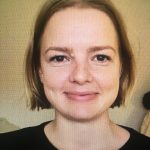
Maja Kruse

Kruse is an interdisciplinary PhD candidate at the University of Maine (External Site) in Orono, and a research assistant on the Holocaust Ghettos Project based at the University of Maine. She holds an MA in German Studies and Geography and Geoinformatics from Denmark. Her work has focused on two GIS projects – an interactive ArcGIS Online web application that allows users to explore three different historic aspects of the Holocaust, and a forest hiding suitability model.
During the Holocaust, 50,000-80,000 Jews went into hiding in local forests to evade the persecution of the German oppressors, some even for years. Because only 10% of the forest fugitives survived the war, sources are scarce or non-existent. Maja uses the words of a few surviving forest fugitives as well as the physical elements of the landscape as sources of evidence, together with GIS, to allow us to better understand the options faced by Jewish victims. Maja’s work taps into the Holocaust Geographies Project, with researchers at University of Maine, Duke, Middlebury College, Washington University at St. Louis, and Columbia University. The project has been developing datasets to capture the spatial distribution and characteristics of places where opponents of the Nazi regime were incarcerated.
Andy Smith-Petersen

Moderator Smith-Petersen has over 30 years of experience in information analysis and management of information systems. He has a Master of Community Planning and Development degree from the Muskie School of Public Service at the University of Maine, GISP certification, and is a licensed water system operator in the State of Maine.
