Citizens to Satellites: Developing an Earth-surface to Space-based Monitoring Framework for Maine
Workshop and Networking Event: Friday, June 24, 2022
A workshop and networking event on Friday, June 24, 2022, hosted by MGI of the University of Maine System and funded by a grant from the Maine Space Grant Consortium (External Site) showcases Maine’s current remote sensing projects and expands collaborations with higher education, community, industry, and K-12 partners. There will also be a discussion on developments around the Maine Spaceport.
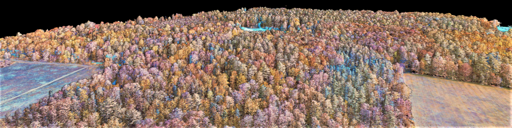
Check out MGI’s remote sensing projects story map (External Site) created by UMaine at Machias student Mike Packer.
Workshop Date: Friday, June 24, 2022
Location: In-person, University of Southern Maine – Portland, with Zoom as an option
Time: 9 a.m. to 2:00 p.m.
Light refreshments/lunch will be served.
If you have any questions, please contact eileen.moran@maine.edu
Directions to the USM campus: https://usm.maine.edu/maps-
Location and Parking: Location is 102 Wishcamper Center, Portland campus (map). Parking is in parking garage adjacent to Wishcamper Center. Please take ticket when entering the garage. Ticket will be validated.
Workshop Schedule
| Time | Agenda | Presenter |
|---|---|---|
| 8:30 – 9 a.m. | Arrival and Registration Light breakfast | – |
| 9 – 9:15 a.m. | Welcome and Introductions | – |
| 9:15 – 9:30 a.m. | Presentation 1: Wheatland Geospatial Lab – “Remote Sensing Inventory & Monitoring of Maine’s Forest Resources” | Tony Guay |
| 9:30 – 9:45 a.m. | Presentation 2: “Remote Sensing Data in Support of Community Resilience” | Tora Johnson |
| 9:45 – 10 a.m. | Presentation 3: “Monitoring Long-term Landscape Trends with Satellite Data” | Firooza Pavri |
| 10 – 10:15 a.m. | Please Share Your Projects: Attendees | – |
| 10:15 – 10:30 a.m. | Break | – |
| 10:30 – 11:30 a.m. | Maine Spaceport Overview and Plans | Terry Shehata |
| 11:30 a.m. – 12:30 p.m. | Lunch and Student Remote Sensing Storymap Presentation | Michael Packer |
| 12:30 – 2 p.m. | Networking and Discussion: new partnerships/projects and frameworks for the future | Facilitator: Pips Veazey |
Workshop Presenters
Tony Guay

Tony Guay is a Remote Sensing Specialist with the Wheatland Geospatial Lab. Guay provides remote sensing and geospatial training to stakeholders in Maine’s forest sector, including industry professionals, small woodland owners, and conservation partners. He supports geospatial science teaching and research efforts in SFR and is responsible for outreach and coordination with various stakeholders throughout the state. Guay is a founding member of the Maine Geospatial Institute (MGI) and serves as chair of its Executive Committee.
Prior to his appointment at UMaine, Guay was an analyst and instructor with RedCastle Resources, Inc. working onsite at the US Forest Service – Remote Sensing Applications Center in Salt Lake City, Utah. During his 18-year tenure at RSAC, he was responsible for coordination, implementation, and management of a national post-fire vegetation severity mapping program. He was also a lead instructor for the training program at RSAC, providing courses and workshops to Forest Service personnel nationwide on a variety of remote sensing and geospatial topics.
Dr. Tora Johnson
Tora Johnson has taught marine, environmental, and geographic information systems (GIS) at the college level since 1996. She teaches GIS and environmental studies at UMM and serves as director of the GIS Laboratory and Service Center and as chair of the Environmental and Biological Sciences Division. Before her son was born in 1996, Tora made a career of teaching and crewing aboard several of the large sailing vessels that ply the coast of New England, as well as commercial fishing in Alaska.
Dr. Johnson’s current human ecological research focuses on political conflicts over marine and coastal resources and the uses of maps in decision-making. Her current social and spatial science research focuses on supporting sustainable and prosperous rural communities in a changing world. Centering on dignity as a guiding principle, her work focuses on best practices for resolving conflict and engaging diverse people in productive decision making. In service projects through the UMM GIS Service Center, Dr. Johnson and her students work with local towns, organizations and businesses to conserve Downeast Maine’s natural resources and plan for a prosperous and sustainable future. She has collaborated with installation artists and sculptors on community-based and place-based installation art projects.
Also a writer, Dr. Johnson’s award-winning book, Entanglements: The Intertwined Fates of Whales and Fishermen, was released in 2005. She was the marine reporter for the Martha’s Vineyard Times from 1998 to 2000. In addition to columns and feature articles for magazines and newspapers, she has published the Guide to Freshwater Animals without Backbones (with Arlene De Strulle; The Catskill Center, 1997).

Dr. Firooza Pavri
Firooza Pavri serves as Director of the Muskie School of Public Service and is Professor of Geography at the University of Southern Maine. Prior to joining USM, she lived in the Midwest and received her M.A. in Geography & Planning at the University of Toledo and Ph.D. in Geography at the Ohio State University respectively. She is originally from India and research and family take her back frequently.
Dr. Pavri’s teaching and research is in the area of environmental geography, with a focus on society environment interactions, natural resource conservation & policy, sustainable development, and geospatial technologies, including satellite imaging. More recently, her work has focused on sub-Arctic and Arctic environments in Iceland and Greenland. In Iceland, she uses satellite data to monitor changes to the Hofsjökull icecap in the central highlands over the past twenty-five years. She also works as part of an interdisciplinary team focused on the Kujataa UNESCO World Heritage site and its surrounding in south Greenland. Her work in Greenland is focused on understanding shifting land cover and vegetation patterns using satellite data from the past three decades. Dr. Pavri’s research has been supported by the National Aeronautics and Space Administration and the National Science Foundation, among others. She is co-author of two books, articles, and reports in her areas of expertise.
Dr. Terry Shehata
Terry Shehata, Executive Director of the Maine Space Grant Consortium, has been involved in economic development for 35 years, with a focus on building the state’s science and technology infrastructure. He has served the role of Associate Director of the Maine Science and Technology Board which became a Commission in the Governor’s Office and then the Vice President of its successor, the Maine Science and Technology Foundation. During his tenure at the Foundation, he coordinated the Maine EPSCoR Program, and the development of the state’s first Science and Technology Plan. He also wrote the proposals that led to a NASA award to establish the Maine Space Grant Consortium, and a NIST award to establish the Maine Manufacturing Extension Partnership.
From 2001 to 2011, Dr. Shehata worked for a small national lean manufacturing and supply chain consulting firm. In 2011, he left the consulting firm and accepted a position at the University of Southern Maine in the Office of Research Administration and Development. In 2015, he became Senior Policy Associate for Research and Economic Development at the Cutler Institute, Muskie School of Public Service. His primary role was the Coordinator of the Maine Economic Improvement Fund, which is used to invest in strategic initiatives at the University that support economic development in Maine. Dr. Shehata retired from the University in September 2021.
Dr. Shehata has served as Executive Director of the Maine Space Grant Consortium, a 501(c)(3) Affiliate-based corporation, since its inception in 1992. The Consortium is a member of a national network of 52 state-based consortia, including Puerto Rico and Washington, D.C. The network is funded by NASA’s National Space Grant College and Fellowship Program, which was established by Congress in 1989 to invest in our states’ aerospace research and education infrastructure that align with both NASA and the state’s priorities.
Workshop Facilitator
Dr. Pips Veazey
Pips Veazey serves as the Director of the University of Maine Portland Gateway, a new initiative that provides a dedicated office in Portland to help people and businesses across Maine access the vast array of research and education opportunities at the flagship research university.
Prior to accepting the director’s position, Dr. Veazey served as the Principal Investigator for the Alaska Experimental Program to Stimulate Competitive Research, a major statewide program funded by the National Science Foundation and the State of Alaska aimed at increasing research capacity and the STEM workforce. She led and co-created the University of Alaska Fairbanks Visualization Space, a high-resolution visual environment designed to enhance shared understanding among circumpolar researchers, community members and organizations; promote conversations about complex problems; and co-develop creative solutions.
Her research focuses on the competencies required to lead large interdisciplinary science teams, and she has worked with dozens of research teams across the country to facilitate the co-development of research collaboration plans. She serves as a founding board member of the International Network for the Science of Team Science, a two-term board member for the Arctic Research Consortium of the United States and a recently elected board member of the Environmental and Energy Technology Council of Maine.